Today I had to go to B&Q, a massive hardware store just south of town, to buy materials for some experimental crayfish tanks (the TANKS are experimental...and the crayfish, har har). Now, getting to B&Q is easy if you take the bus. But because I would be buying sheets of plexiglass (a.k.a. 'perspex'), I had to drive. For some reason, I find it very hard to wrap my head around south Leeds. None of Leeds is grid-like, the roads just go every which way, and its particularly harsh in the south. So I looked at the map carefully and planned the EASIEST route. It looked something like this:
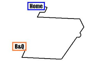
It looks like a big horseshoe, mainly because there are limited bridges to cross the River Aire, on the other side of which is B&Q. However, once I was about 1/3 of the way there, the roadsigns stopped making sense. They advertised roads that just didn't seem to appear on the map, and the road I wanted was not listed on the sign! But, thank heavens, the British love them some football, and Elland Road stadium was advertised on ALL the road signs. This stadium just happens to be close to B&Q. Win. So I just followed the stadium signs. My actual route was something like this:

On the way back, I again looked at the map, then realized as soon as I pulled out that it had been a futile effort. The road I was going to take was not marked on the signs. But Headingly stadium was, and that is near my house (relatively) so once again I set off following the stadium signs. And neither times did I make a single wrong turn. So I guess the moral of the story is to know what stadiums are near your destination, and just follow the signs...the roads in Leeds are notoriously poorly signed, its not just me!
 It looks like a big horseshoe, mainly because there are limited bridges to cross the River Aire, on the other side of which is B&Q. However, once I was about 1/3 of the way there, the roadsigns stopped making sense. They advertised roads that just didn't seem to appear on the map, and the road I wanted was not listed on the sign! But, thank heavens, the British love them some football, and Elland Road stadium was advertised on ALL the road signs. This stadium just happens to be close to B&Q. Win. So I just followed the stadium signs. My actual route was something like this:
 On the way back, I again looked at the map, then realized as soon as I pulled out that it had been a futile effort. The road I was going to take was not marked on the signs. But Headingly stadium was, and that is near my house (relatively) so once again I set off following the stadium signs. And neither times did I make a single wrong turn. So I guess the moral of the story is to know what stadiums are near your destination, and just follow the signs...the roads in Leeds are notoriously poorly signed, its not just me!
1 comment:
Uh oh! at least you got to your destination and back.
Post a Comment